


One of our objectives this summer was to do more hiking in Glacier National Park. We are now camped just a few miles from the West Glacier, Montana, park entrance. My Lovely Bride did some research on “Best Hikes” while I was driving, and came up with several that we would have time to complete. Our hikes are time-limited in that we do not leave Rudy and Gretchen alone for more than seven hours. Our first hike was a twofer, combining the Trail of the Cedars and the Avalanche Lake Trail. Here is Your Faithful Correspondent admiring the cedars and hemlocks on a lovely sylvan path. While well-worn, the path was (relatively) lightly traveled, and we also appreciated that most hikers were considerate of the quiet, cathedral-like environment and kept their voices low.

Glacier is known for its lofty peaks, even higher than those found near our home in The Villages, FL. This is Mt. Clements, 8,760 feet. We are viewing from about 3,450 feet; that’s just over 5,300 feet, more than one mile of elevation difference… a lot of rock, and a bit too steep to climb.

Since a climb up Clements Mtn. would be rather strenuous, we headed up an easier trail along Avalanche Creek. The rushing waters were raucous, especially through a gorge cut through the living rock by this small but powerful glacially-fed stream.

While grizzly bears are one of the serious topics of concern locally, the biggest danger here in Glacier is actually water. Drowning in fast moving, ice-cold streams is the most common cause of accidental deaths in Glacier, with falls while climbing or hiking coming in second place. Regarding bears, most hikers carry bear spray, but it is very rare that it ever has to be used in self-defense.
 Our turnaround was at Avalanche Lake, which is fed by the Sperry Glacier on Gunsight Mountain. All of the park’s glaciers were formed during the Little Ice Age, a period of cooler temperatures starting in the 13th Century and concluding in the mid-1800’s.
 Our second day of hiking was one we had been looking forward to all summer, the Highline Trail. Here we find Suzanne checking out the route at the trailhead, with the back side of Bearhat Mountain, 8,684 feet, looming in the background. You may observe that she is wearing a fleece under a windbreaker. It was in the high 40s even in the sun, and layering was a necessity. By the way, while looking at Internet posts about the hike, we found an interesting story from just a week prior, when one hiker had to climb down a steep cliff face to avoid a grizzly bear approaching on a very narrow part of the trail… you can see the photos of this encounter taken by another hiker here. Coincidentally, this was the same area where just last year a young newlywed pushed her husband off a cliff following an argument. She got 30 years, by the way.

Here is My Lovely Bride,in the same area, sans grizzly or homicidal newlywed. You may note a green wire cable affixed to the wall to provide added security. A narrow two-lane road, the Going to the Sun Highway, is about 300 feet below her, out of the photo. The maximum length vehicle allowed on this road is 21 feet, so all you see on the road are bikes, cars, pickups, shuttle vans, and the park’s open roof red taxis. Oh, and I forgot to mention the occasional Harley, whose intentionally very loud exhaust noises can be heard for miles reverberating from mountainside to mountainside – “there oughta be a law…”

Wildflowers were running riot throughout our hike, many of which I could not identify. This three to five foot tall flower is bear grass, also known as squaw grass (Xerophylum tenax). The latter name derives from one of its uses by Indians in making baskets. Plant colonies typically only bloom every 5-7 years, so we were lucky to see these.
 The mountain scenery of Glacier National Park is breathtaking. It was always near the top of my bucket list, and this is now our third visit, and we have only begun to make a dent on the list of many trails, lakes and peaks that we want to experience. Part of the problem is that because of the typically late Spring and early Fall snowfalls, July, August and September are the only months to hike here. Three years ago we arrived on July 3rd, and the Going to the Sun Road had been closed due to heavy snow until just the day before.
 Speaking of snow, this picture is a bit deceiving. We were standing on a relatively small patch of snow just off the Highline Trail at Haystack Pass, but the surrounding air temperature was in the 70s, so we were quite comfortable in shorts, and in fact I had been sweating because of the uphill climbs… My Lovely Bride, being a woman, does not sweat. She may glisten, but she never sweats.
 This photo illustrates a quality of Glacier NP that becomes very evident once you arrive – there are very few flat spots in this park. This knifedge ridge, actually a glacier-cut arete known as the Garden Wall, is a rock climber’s dream, but we opted to skip this very technically challenging route for a quicker return to the car because (a) Rudy and Gretchen were missing us, and (b) there was a nice bottle of Cabernet awaiting our return as well.
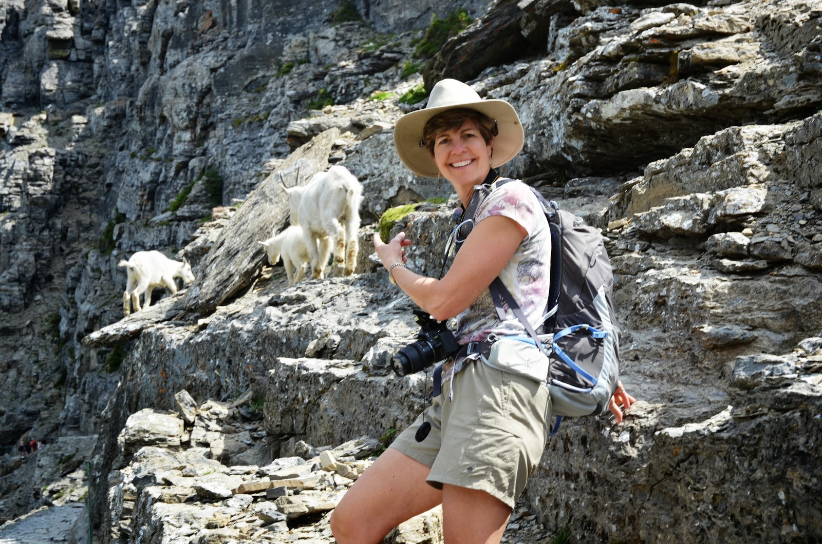
Just before arriving back at the trailhead, Suzanne noted a wildlife roadblock ahead. It wasn’t a grizzly, but three mountain goats (Oreamnos americanus) who were walking calmly down the trail. Mountain goats have double layers of wool that allow them to survive winter temperatures to 50 below 0 F and winds to 100 mph. They are amazingly sure-footed, able to climb 60 degree slopes with ease.
 Fortunately, this family gathering was only temporary, and we were able to safely complete the remainder of the trail without any cliff traverses. Although I have been called an Old Goat, I do not claim to have the same sure-footedness as this fellow.