

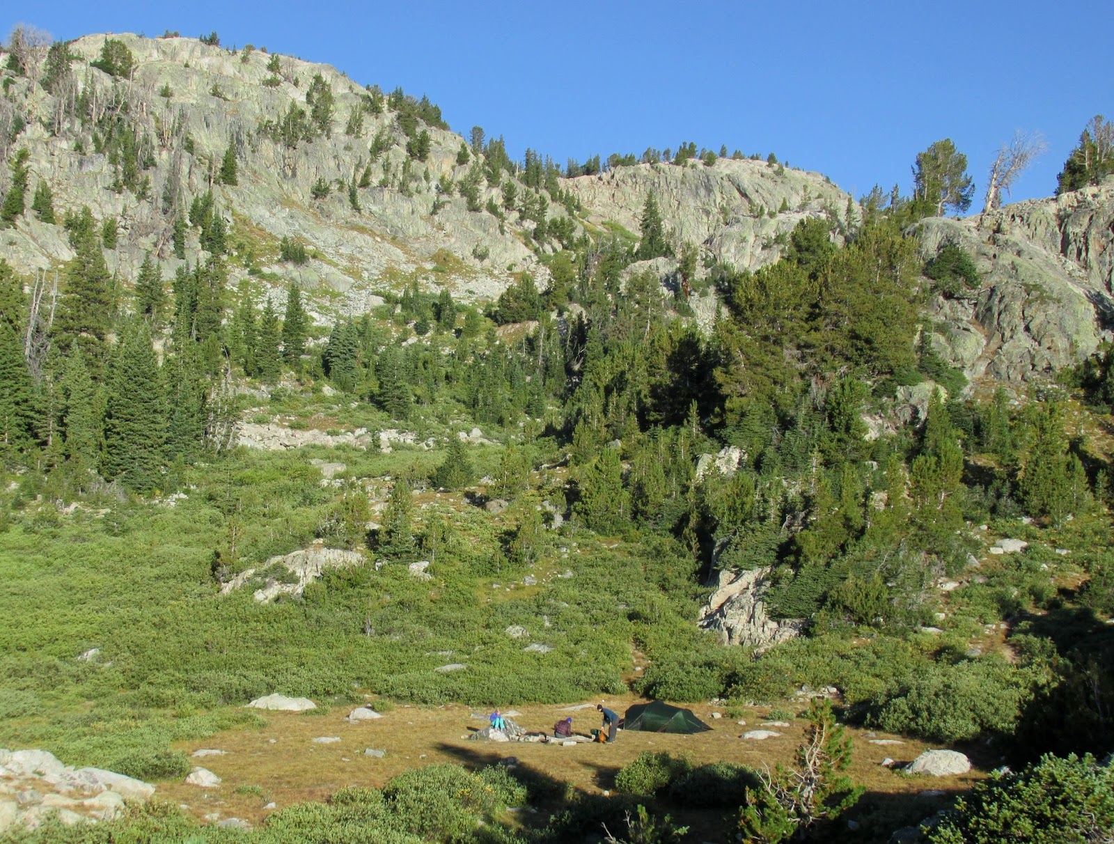
 I have hiked a lot of places around the US, Canada, Europe and New Zealand, and my trip to Wyoming’s majestic Wind River Range certainly rated in the top 3 I have ever completed. After a 10 mile hike the first day, and stopping for the night at Seneca Lake (10,350 ft), I had breakfast and coffee and looked around to find another campsite about 100 yards away – a family of four camped in a nearby meadow; they had come in after I arrived, and were the only people in sight for miles around.
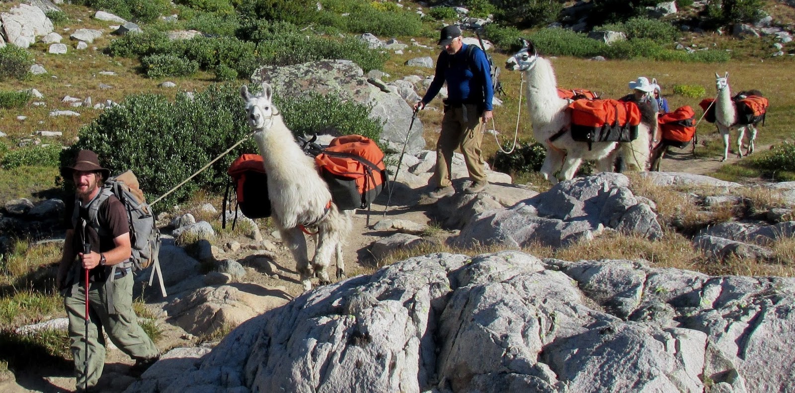
By 0830 I had struck camp and headed up the trail deeper into “The Winds”. I was carrying 32 lbs of gear, food and water, making 2 mph, a decent speed for An Old Guy at this elevation. When I saw this pack train of llamas headed back out to the trailhead, I had to ask the outfitter a few questions. Llamas’ average speed is about 2 mph as well, but since these folks are only carrying light daypacks with water, snacks and camera, they can hike longer days than a typical backpacker. Llamas can carry as much as 75-100 lbs, meaning that I could have taken this easy way in and brought a camp chair, wine, Cheetos, steaks, Oreos, books and maybe even a telescope. What was I thinking???  A couple of hours later, I took a snack break on a ledge above Island Lake. There were good campsites here, but I was hoping to spend the night up higher, so I pressed on…
 There are hundreds of beautiful, but unnamed, small glacial lakes called tarns up in these mountains. They are formed in cirques or in depressions bordered by moraines, and are filled by snowmelt or rainwater, rather than by springs.
 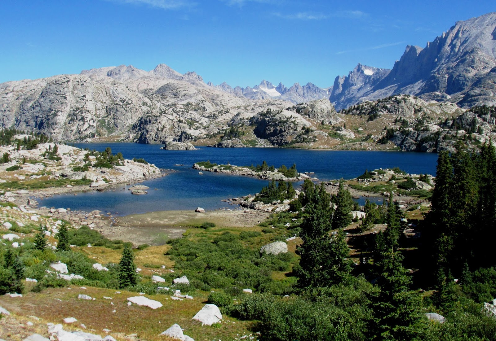 After a few miles, the lowest of the Titcomb Lakes came into view. I am right at the edge of treeline here, and the few trees visible are getting progressively smaller as I climb. The low shrubs are called krumholtz, German for crooked, bent or twisted wood. High winds and heavy snowfall makes for unusual shapes, and they are dense near ground level. A common variety here is Engelmann spruce (Picea engelmannii).
  There weren’t many people here, but I caught up to one couple crossing this boulder field; the trail became indistinct here, and we helped each other find the best way across. This would not be a good place to fall…
 Then, after crossing a saddle, the full panorama of Titcomb Basin came into view. I sat for a half hour just to take it all in, but I wanted to stay for a week. Some of the tallest peaks here are Fremont Peak (13,745 ft), Mount Sacajawea (13,569), Spearhead Pinnacle (13,200 ft), and Mt. Woodrow Wilson (13,258 ft), all with popular mountaineering and rock climbing routes. I am past the days of peak-bagging (climbing to the summits), and being alone, that would be a really stupid thing to do, so now I simply enjoy their beauty from 2-3 thousand feet below the summits.

Of course, I had to have proof for My Lovely Bride that I had not simply camped out in the back yard of the local Hooters or Twin Peaks, so I asked another backpacker to take my picture. No Photoshop allowed here; it’s really me! (As it turned out, Suzanne knew exactly where I was… read on!) There were no sheltered campsites up in Titcomb Basin, and cold winds in the 20s were forecast for that night, so I decided to hike back to Island Lake to camp. I found a nice spot near the lakeside, with a great view and decent-sized pines and krumholtz to break the wind. The only trouble arose when a nearby group of hikers (two couples from Princeton, New Jersey) who had their gear packed in by horses set up their camp chairs upwind of me – its not that they smelled bad, but at sunset, all four proceeded to light up and smoke cigars! I was just a bit put out (that’s putting it very mildly) and searched my pack, muttering, “Now where did I put that hand grenade???” I should have thought about the bear spray I was carrying…

I enjoyed watching the sunset (the rosy light is called alpenglow in the mountains) on Elephant Head (Cairn Peak, 12,172 ft) with a cup of coffee and some M&Ms. It could only have been better with Suzanne, Rudy and Gretchen to share it with, but they were miles and days away.  The trip had gone well until the third morning – this was the scene by the dawn’s early light – when I woke up and started making coffee. When I leaned over to light my stove, I felt a spasm in my lower back muscles like I haven’t felt in years. The result of a boating injury back in 1980, the pain can often put me flat on my back for a day or two, but that wasn’t an option with 15 miles back to the trailhead. I took a muscle relaxer and packed up for the two-day trip out. I cinched up my backpack and waistbelt tightly and started hiking; it was okay as long as I didn’t slip on any rocks. Thankfully, I had two aluminum trekking poles to help keep my balance on tricky parts of the trail. I hiked carefully, not wanting to be incapacitated and have to be carried out.
 At one point a pack train with a couple of unladen mules passed me; I almost thought about hiring one for a ride back, but I could almost hear my Marine daughter Susan whispering from the other side, “Dad… Suck it up! Mules are for sissies!”
  My last night in The Winds was spent at Eklund Lake, but the only decent spot I could find was in a thick stand of pines with no view. I did get some sleep, in between spells of lower back discomfort and occasional sliding off my inflatable mattress due to the downhill slope. The next morning was overcast, as evidenced by this photo from Photographers Point.
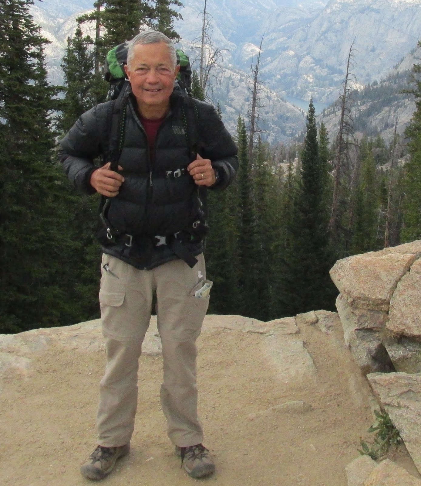 It was also downright cold… that’s kind of a pun, as proven by this dashing young backpacker dressed in his goose down jacket. (Maybe I should send this photo to GQ or Outside magazine… and then again, maybe not.)
 One of the funniest moments of the trip came when a trail running family from Colorado Springs ran by. The husband was a professional ultra-marathoner, and flashed by in an instant. He was followed a half hour later by his wife and two kids (all running), and their Yorkie Daisy! This little dog often runs 10 miles with the husband, often out in front of him urging him on!
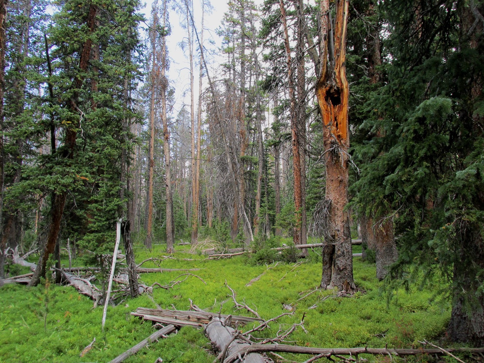 The terrain and forest changed a lot as I dropped in elevation below 10,000 ft.; more big trees and lush, bright green foliage predominate here.
 There must have been a serious windstorm since I started my trip, because these two big Ponderosa pines had fallen across the trail in the four days I was out. Another backpacker ahead of me trying to squeeze under the trees actually got stuck for a few minutes. I learned from her predicament and took my pack off before crawling carefully under the obstacle – with my back issue, I decided that doing a limbo routine to get through wasn’t in the cards.
 When I approached the trailhead, I figured I would have to wait an hour or so for Suzanne to pick me up at the agreed-upon time. Imagine my surprise when as I walked out of the woods, she was driving up with a big grin on her face! I had forgotten that Gina Feltner had loaned me a SPOT emergency locator beacon, “just in case”, and that Suzanne would be tracking me the whole time I was up in the mountains… at least if I had gotten into any trouble, they would have known where to look for me. All in all, this was one of the best backpacking trips I’ve ever taken, even with my back pain. The scenery was spectacular, and there were far fewer people out in the mountains than I had expected. I am already looking forward to returning to Pinedale and Wyoming’s rugged and beautiful Wind River Range. (But it was sure great to see Suzanne’s big smile welcoming me home! She was also very gracious in not asking me to open the car window on the drive back to the coach, since I hadn’t had a shower in four days…)
5 Comments
S/V Magnolia
You need to add a Lama and a maybe a couple of M67s to the equipment list…
Anonymous
Hope your back is feeling better Ty. Last time I was in that beautiful area was on a forest fire. We flew up to 10,000+ feet in helicopters though. It is some big country for sure! I won't comment on the lack of wilderness ethics from those Jerseyites. As a previous Wilderness Ranger I've seen much worse…
Ty and Suzanne Giesemann
I've already updated the spreadsheet… now if the supply weenies can just get that 1049 to go through…
Ty and Suzanne Giesemann
Brad, I can only imagine on the nitwits you might run across as a wilderness ranger! Especially during hunting season…
Ty and Suzanne Giesemann
Brad, Hope this post gets to you. Tried to email you about dinner in Asheville, but don't have your new email address; we arrive Tuesday 27 Sep for several days. Please call us (571) 236-3541 or (904) 612-1752 if you get this. Cheers, Ty & Suzanne