


Sometimes My Lovely Bride has a Minimal Sense of Humor. We had just arrived at our new campground near Pendleton, Oregon, and were driving around town. It is a cute town, home of Pendleton Woolen Mills, an American icon. I will get to that in a few minutes… Anyway, as we passed a very interesting sign, I said to MLB, “Hey, Sweetheart, I think I should go for a walk and get some human interest inputs for the blog.” Ever supportive, she replied, “Of course, My Darling. Where are you going?” My error was saying, “Well, I thought I’d go in that building right there and meet some of the locals.” She looked up, frowned, and ….. Smack, smack…
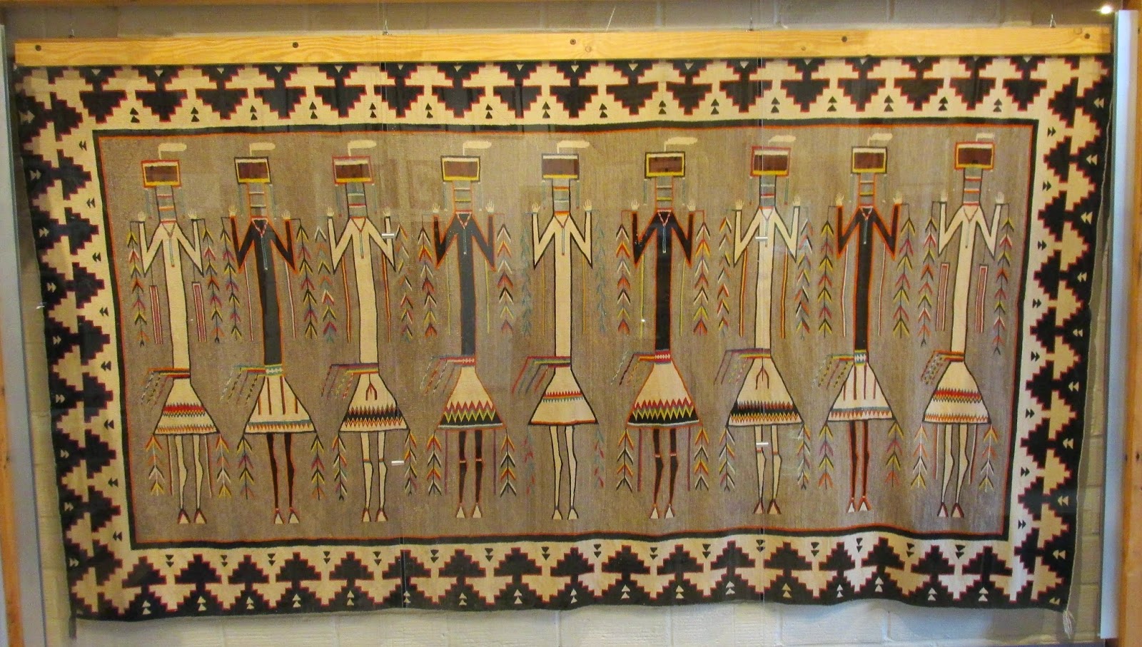 Our next stop was at Pendleton Woolen Mills. Unfortunately, we arrived just 20 minutes too late for the tour, but the outlet and store were still open, and in spite of my bruises and swollen eye, I did appreciate the excellent craftsmanship of the clothes and blankets offered therein. Pendleton started out as a manufacturer of blankets for many Indian tribes in the western US. Since eastern Oregon is sheep country, having the source of raw materials nearby cut their costs considerably, and Pendleton became the primary producer of Indian blankets in the US. (This beauty was in their historic collection.)

This beauty is contemporary rather than historical, but was observed admiring the Pendleton stock; fortunately, she decided that we were lacking storage room in The Coach for the several beautiful woolen blankets and winter sweaters that otherwise may have made it into her inventory…
 The only problem with our arrival in Oregon, other than that unfortunate event mentioned in this blog’s initial paragraph, was that it rained for the first 24 hours we were here. I guess that’s fairly normal for Oregon from October 1 to July 1; their dry season (dry being a relative term) runs from July through September. We had set up camp in Emigrant Springs State Park, on the crest of the Blue Mountains near Meacham. The scenery was quite a change from Utah and Idaho, with spruce trees replacing the pines and red diggers (Columbian ground squirrels, Urocitellus columbianus) replacing the gophers that Rudy and Gretchen had come to love (and chase) in Salt Lake City, Zion and Sedona.
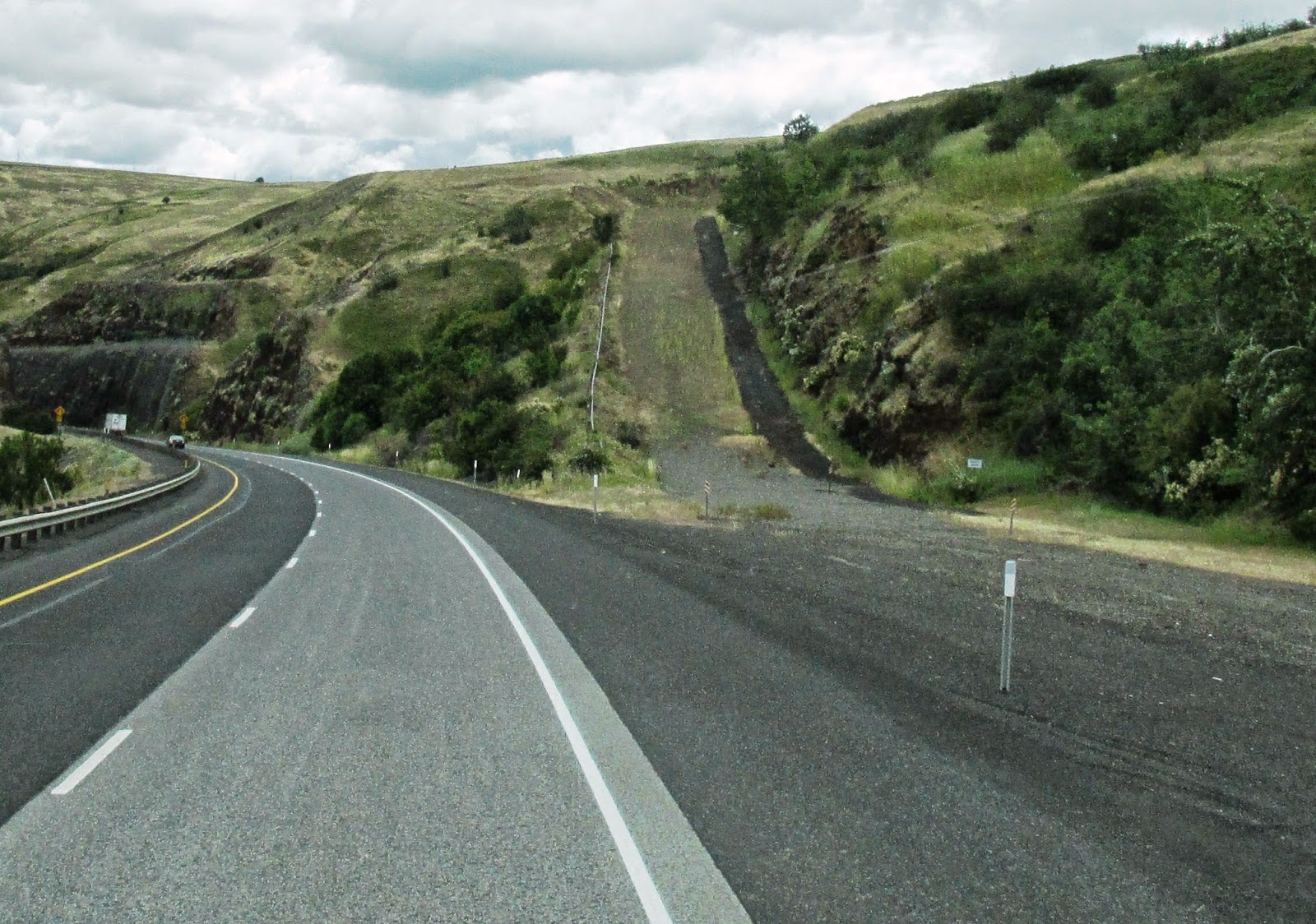
 On the drive down from the Blue Mountains, this ominous “Last Warning” sign gave us pause for a moment, along with the apparent drop-off just ahead…
 A 6% downgrade doesn’t sound that bad; until you look out the window and see what’s ahead… sweeping curves with those attention-getting tilting truck signs and 35-45 mph speed limits for trucks, buses and coaches like us. If you didn’t use the brakes, you’d quickly accelerate to 70-75 mph and go out of control, what we call in the Navy “N.G.: Not Good”. Fortunately, we have an engine exhaust brake (like Jake brakes on semis) that allows you to take your foot off the brake pedal and let engine compression slow your vehicle to a safe speed.
 But just in case your brakes fail, the well-designed Runaway Truck Ramp awaits. This one is filled with sand and gravel to dissipate the momentum of big trucks and buses, but they can also be made with stainless steel arresting wires and nets… either way, hitting it at 75 or 80 would be exciting, even better than the old E ticket rides at Disney!
 The terrain changed quickly as we came alongside the Columbia River…it is one of the prettiest drives in America. This was the final leg of the route Lewis and Clark made in 1805 from St. Louis to the Pacific Ocean, and that pioneers followed along the Oregon Trail later that century.
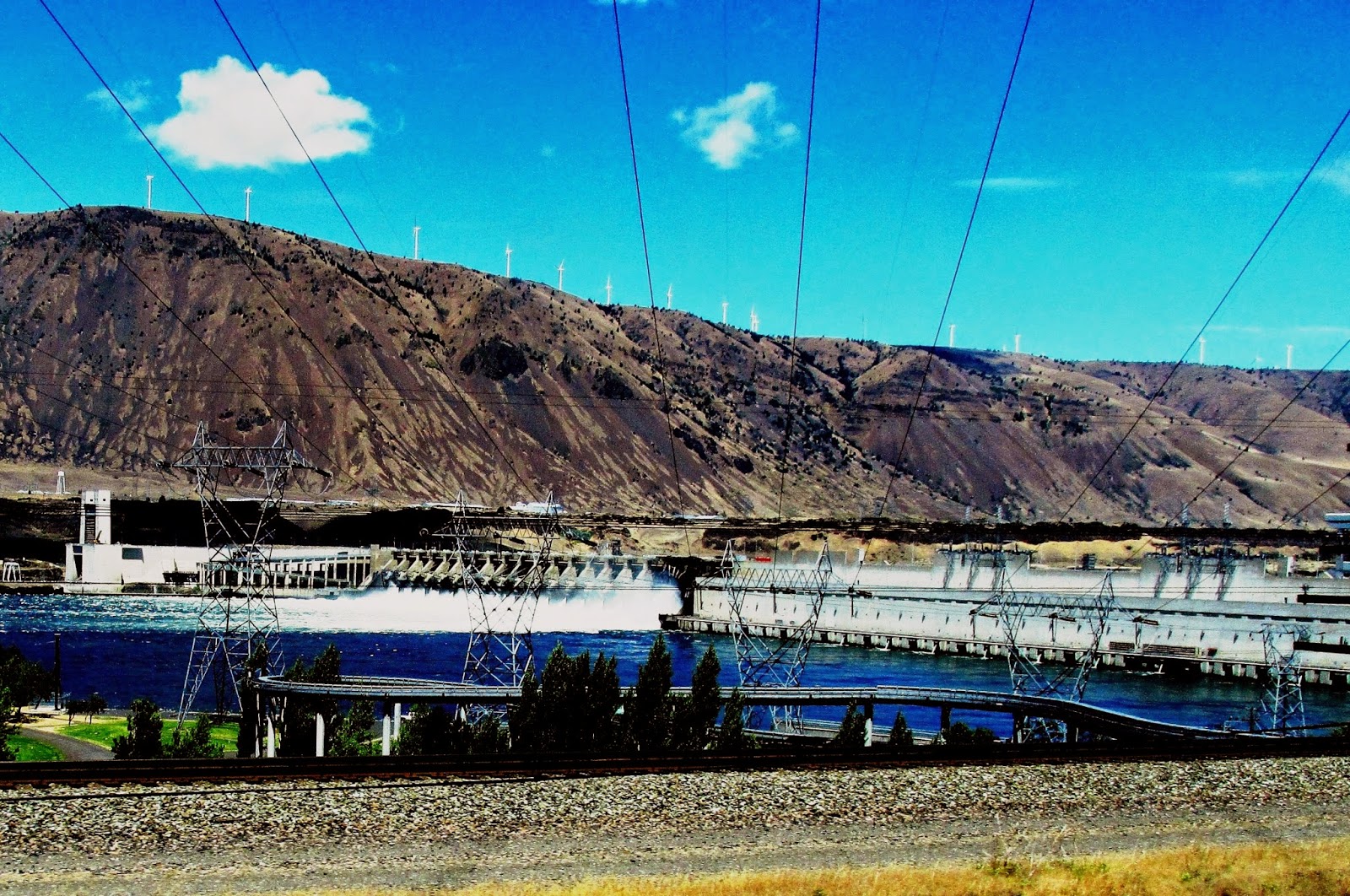 What has changed since 1805 is the series of dams and spillways with massive hydroelectric power generation capacity. This is the Bonneville Dam, which was built during the Depression by 3,000 men from the welfare rolls; they were paid 50 cents per hour in non-stop 8 hour shifts to complete the project in 4 years. The dam’s two powerhouses produce over 1,000 megawatts of electricity, the equivalent of an average nuclear power plant.
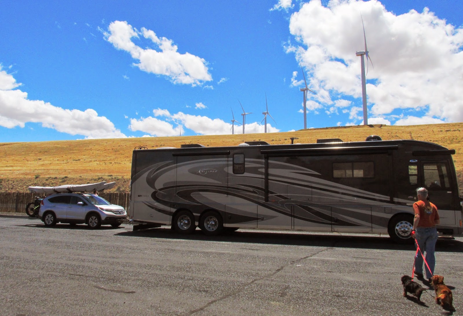
More recently, wind power has become viable here, since the Columbia Gorge is one of the windiest places in North America. We stopped for lunch at a rest stop along the river with a wind farm on the cliffs above. These are only a few of hundreds of wind turbines placed on ridges and hilltops on both the Washington and Oregon sides of the Columbia River. Back in 1998, Suzanne and I did a duathlon here, with a 10K run and a 42K bike ride. The bike portion was a killer, going up from the river to the scenic overlook via switchbacks, then down toward Portland. It was so windy that you had to pedal hard going downhill!
 As you approach Portland, the slopes along the Columbia River get greener. Every now and then you get a shot at Mount Hood’s snowbanks in the far distance, although the peak remains tantalizingly draped in clouds.
 Finally, June 29th is a special day here in The Coach. It’s our 18th anniversary. Lest any cynical reader think that My Lovely Bride must be pretty bored by being married to an Old Coot for the past 18 years, I have photographic proof that she actually is a Happy, Swinging Chick…