


From our stop in northern Arizona, we drove another couple of hundred miles to our destination, Zion National Park. Zion is one of my favorite places on Planet Earth. In Hebrew, Zion was a place name used as a synonym for Jerusalem. In Kabbalah, Zion refers to the spiritual point from which reality emerges. Zion was named by a Mormon farmer, Isaac Behunin, who lived and worked the land here for decades in the 19th Century; his meaning of the word was taken from the Bible as a place of peace. Whichever definition you prefer, Zion is a place that once you have visited, you will want to return again and again. This was my fifth trip, Suzanne’s fourth, and I would be happy to have my ashes scattered here one day.
 Zion would also be the location for another overnight solo backpacking trip for Your Faithful Correspondent, and on our second morning here, My Lovely Bride drove me for an hour on a bumpy dirt road (DANGER: Road may be impassable in wet conditions!”) to the Lava Point trailhead, the start of the iconic Zion West Rim Trail. She hiked with me for about an hour, and then we had a quick lunch together before she returned to the car for the drive back to Rudy and Gretchen and The Coach in a campground in Springdale, Utah.

The West Rim is an extremely popular trail, and I had to reserve a campsite (one of only 8 on this trail). Because it is early summer, many springs are already dry, and I had to carry 5 liters of water for the two day trip. This added 10 lbs to the weight of my backpack, which ran to about 36 lbs for this trip. At 7,890 feet, the going can be a bit tough, the trail traversing a rocky and occasionally sandy path through high alpine terrain, but the beautiful scenery made it all worthwhile.
 I was happy to arrive at camp 7 and set up my tent for the night. The site will accommodate four backpackers, but since my “party” was a total of one, I was alone for the night. That was fine with me, because that was what I was here for… that’s my backpack hanging from a dead tree limb. It kept it out of the dirt and away from scavenging squirrels until I put it inside the tent with me when I retired.
 Before dinner, I decided to recon (scout) Potato Hollow, the area of my campsite. I didn’t find any potatoes, but the foliage was luxuriant, perfect for the several mule deer I saw browsing in the distance.
 My gourmet dehydrated beef stew dinner, complete with table setting for one, is shown here. “Open package. Remove and discard oxygen absorber. Carefully add 2 cups of boiling water to pouch. Let stand 8-9 minutes. Stir and serve.” In an effort to save weight, I had decided (foolishly) to abstain from a nice 8 oz. Platypus Cabernet on this trip. Sigh.
 A postprandial walk led me to a lovely grove of aspens, including this tree with an all-seeing eye…is Big Brother watching me here in the woods?
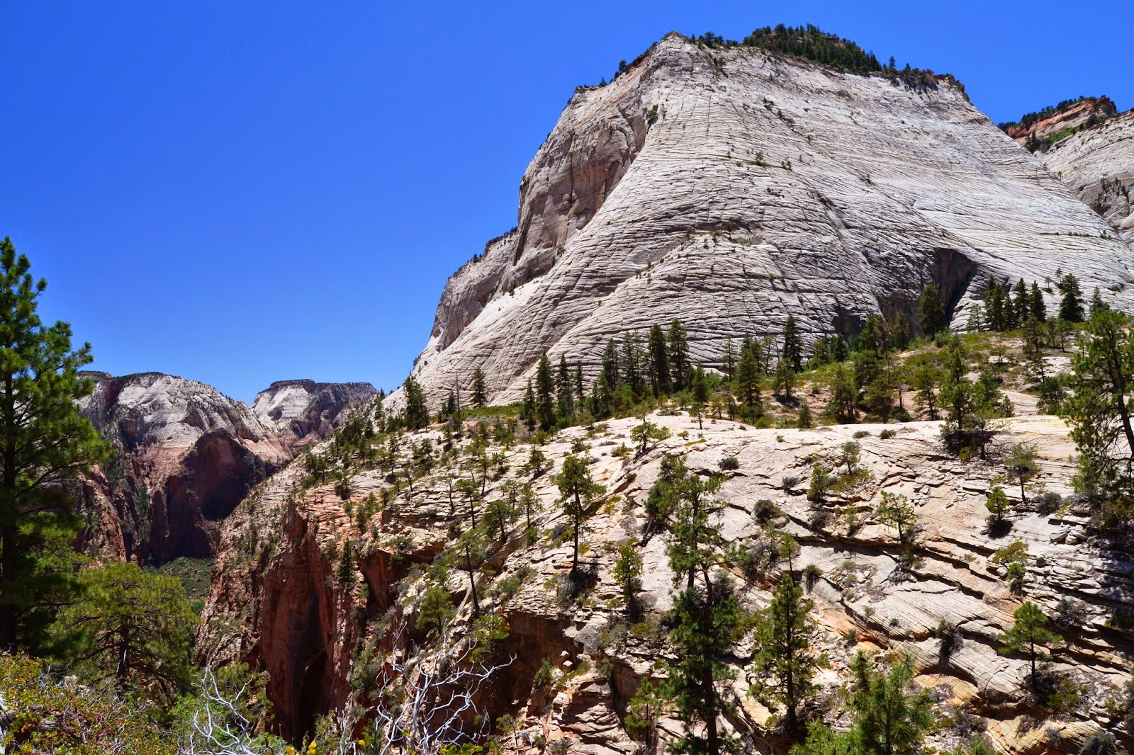
 After a good night’s sleep with Big Agnes… oh, I guess I should explain that analogy… my air mattress is made by the Big Agnes company in Colorado, named after either (a) a rocky peak outside Steamboat Springs, or (b) a laid-back mountain town mama. In any case, I awoke with the sun and set off hiking the actual West Rim Trail, with views of nearby peaks and valleys that took my breath away.


 After almost four hours of hiking, I was running a bit low on water, and stopped at the only reliable spring on the trail. For those of you who take visitors in Florida to Silver Springs, which produces about 550 million gallons of water daily, you may be surprised at the size of West Rim Spring, shown here with my sunglasses to compare for scale. I did obtain 3 liters of excellent water from this tiny spring, after purifying it. Only a handful of backpackers use this spring each day, but it sustains life for deer, elk, squirrels, coyotes, rabbits and birds in the high desert.
 From the spring, the trail dropped down the side of a mountain rather precipitously. Merriam-Webster defines precipice as “a very steep side of a mountain or cliff”; also, “a point where danger, trouble, or difficulty begins”. The trail you see here is about 5 feet wide, and to the right of the photo is an 800 foot cliff. The trail switchbacked along the cliff face for about a mile to the canyon floor below.
This photo shows what the cliff looked like from below… the trail runs alongside the two trees at top center. I have never suffered from vertigo or fear of heights, but when I looked over the edge from the top, I wondered for a moment or two if this really was a good idea. But it all turned out okay, and the worst part of the way down was thinking about the consequences of a misstep. Needless to say, I did concentrate on where I was planting my feet.

 Several hundred feet below the first photo, the trail moderated considerably; it ran along a “shelf” where you can see bushes along the rock face, about 2/3 of the way up the curved slope.
 Near the bottom of the trail, I felt some unease… not from the steep trail, but from a sense of being watched…but there was no one around!
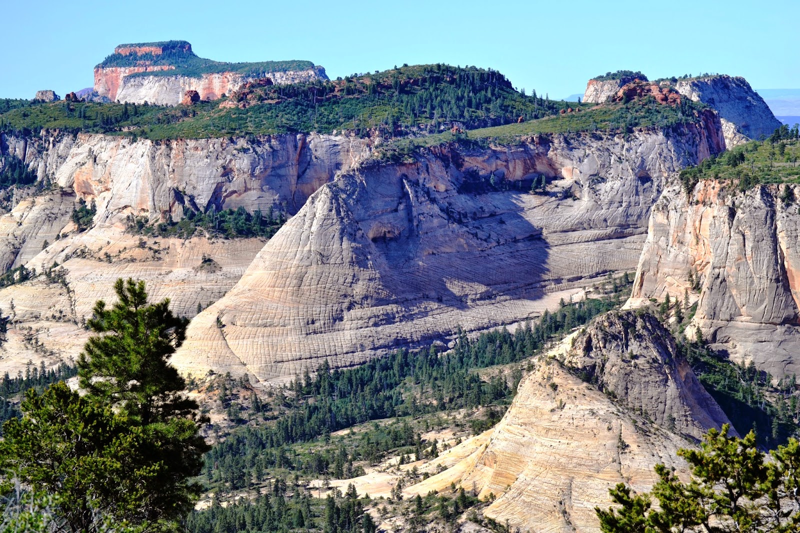
 One of the unique aspects of Zion are the remarkable rock formations, like this checkerboard sandstone…
 Near the intersection of the West Rim Trail and the Angels Landing Trail, I started to meet people. Remember, I hadn’t spoken to anyone else in about 28 hours. When was the last time you went that long without speaking to a neighbor or friend, either on the sidewalk, at the store, or on the phone? I had to ask one lady to take my picture, again to prove to My Lovely Bride that I was indeed out in the boonies and not hanging out at the local Hooters…
 A return to civilization has its benefits, but it was hard to leave the beauty of wilderness mountain scenery like Zion offers…

The Angels Landing Trail drops 1,488 feet from a dizzying viewpoint to the Virgin River valley below. It’s not technical, but very, very steep in places…

This set of switchbacks with its crowd of hikers going up and down was a study in contrasts to what I had experienced over the past two days. (I think I prefer the solitude of the backcountry…)

 This final photo shows Angels Landing from the side. It is one of the most recognizable landmarks in the Southwest, and if you haven’t been to Zion before, I recommend a visit here to experience this unique treasure. (To get a sense of scale, from valley floor to peak, it’s higher than the Empire State Building, and in the photo, there is a 100 foot long, double shuttle bus in the lower center. It’s so small you may need a magnifying glass to see it.)
For me, a humble hiker and backpacker, Zion achieved its meanings… a place of peace as well as a spiritual point from which reality emerges. But what is reality????
3 Comments
Anonymous
I enjoy my Big Agnes sleeping bag and pad. It's a bit heavy for backcountry use but perfect for wildfire assignments. Thanks for the pics! Brad
Ty and Suzanne Giesemann
Brad,
Glad you've got good gear for your specialized, dangerous work. Does the Forest service provide or do you pick your own? BTW, another round of appreciation for the USFS for all the great trails we've enjoyed this trip outside of the better publicized national parks.
Cheers, Ty
Anonymous
The Forest Service supplies cheaper bags but decided to buy my own for comfort sake. You can slide the pad in an opening under the bag to keep it from slipping during the night. A vast improvement over waking up on rocks!
Glad you are finding well maintained trails on your trip. Sounds like you may want to increase your life insurance policy though!