

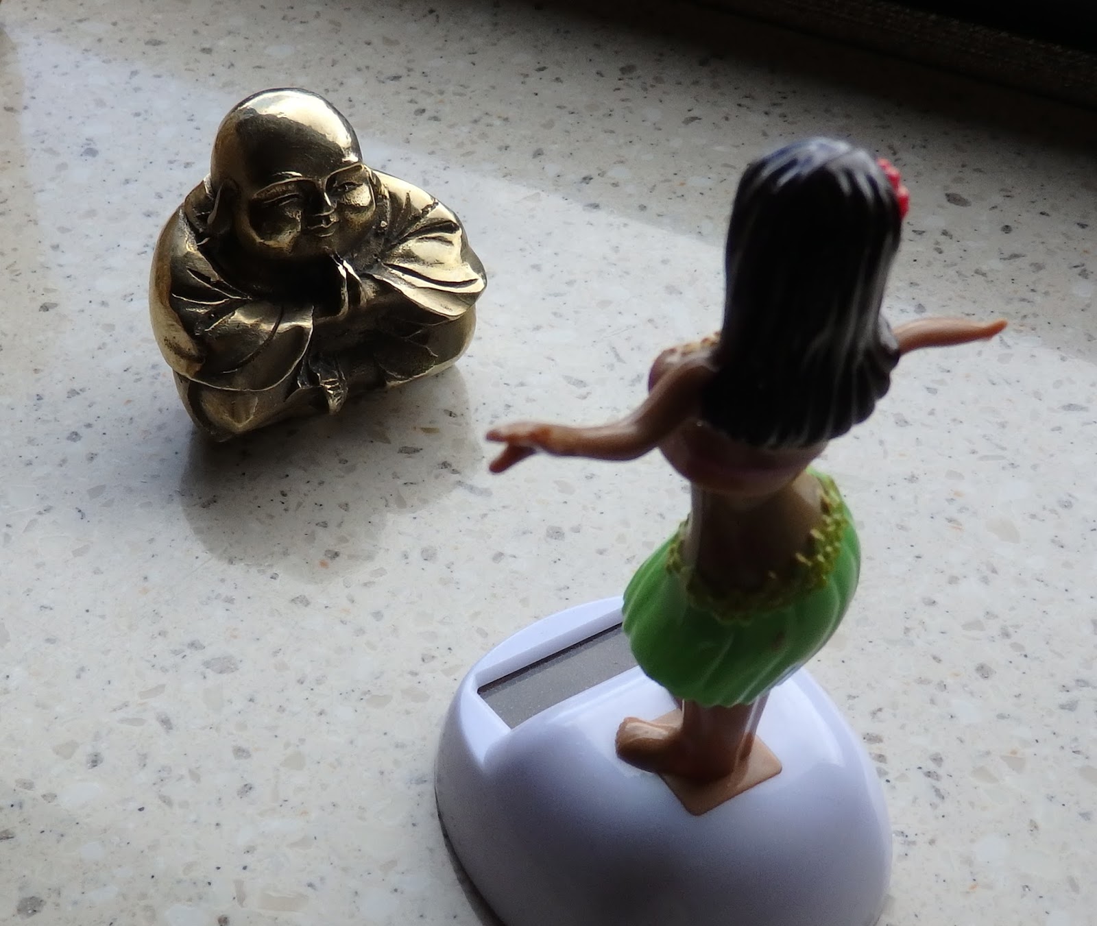
 Faithful Readers of this blog may recall the interaction of Buddha and Hula Babe described in an earlier post. I received this amazing interpretation from my spiritual guru, Judson Emens: A Case for Buddha Love: Buddha’s perception of the solid, yet undeniably curvaceous, reality before him belies the absolute reality of Hula Babe’s rapidly pulsating and undulating matrix of gyrating fields of energy. The predictable patterns of waves from Hula Babe’s effortless, yet appealing bumping and grinding rapidly interact, at the velocity of the speed of light, with a higher vibratory frequency than Buddha can assimilate and subsequently our little Buddha-man is reduced to being, alas, just a man. His reality is no longer absolute. His holographic matrix has been penetrated at a depth that he has, heretofore, never known and therefore the altered state of consciousness he prefers is replaced by the altered state of consciousness that she prefers. R.I.P. Little Buddha Man
  While still trying to fully digest Judson’s amazingly incisive spiritual treatise, we departed Page, AZ, and headed north to Utah. This sunrise view is of the mountains west of Glen Canyon Dam; I had read of the Paria Canyon Wilderness, but hearing George Hardeen tell about his week-long backpacking adventures there made me wish we had more time here in northern Arizona.
The drive to Zion was relatively short, but as we made our way up the Virgin River Valley, the terrain got more and more impressive. Our campground was in the town of Virgin, within view of these cliffs.
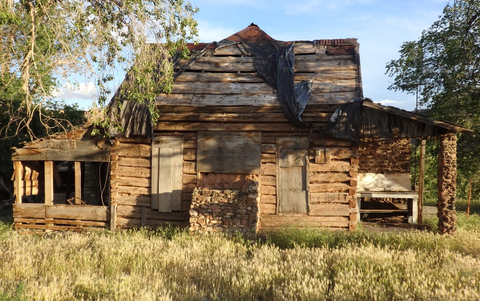 We arrived too late for a long hike, so we set up camp and took a walk through the town of Virgin. I suggested that this “fixer-upper” might be for sale. My Lovely Bride simply lifted an eyebrow. Funny how complex thoughts can be transmitted without any words being spoken…
We got out for our first hike in Zion National Park the next day; the Watchman Trail is located right near the Visitor Center, but it’s not exactly flat. There are several steep sections with overhanging sandstone cliffs. My Lovely Bride asked, “Ty, what keeps those slabs of rock from falling?” “Well, my dear, the only thing holding them up is friction, and often they come crashing down – hopefully not while we are standing here talking about them… let’s keep it movin’!”
 It’s been a wet spring here in the Southwest, and we have seen lots of light rain, and some quite heavy, while in Arizona and Utah. On the positive side, the desert is in bloom, with many wildflowers showing their colors. (Colette, I need your help identifying this one!)
  Suzanne found this perfectly formed sandstone chair to relax upon during our hike up the Watchman. I briefly thought about stuffing it into Suzanne’s backpack, but of course the Park Service would frown upon its removal…
  I had been planning a solo, two-day backpacking trip for several weeks. MLB would be giving readings and staying with Rudy and Gretchen in the coach while I hiked Zion’s East Rim Trail. The drive to the park’s East Entrance along Utah Route 9, the Zion-Mt. Carmel Highway, provided a great view of Checkerboard Mesa. The mountain is comprised of Navajo sandstone, the most widespread rock layer in the western US. In Zion, this layer of sandstone exceeds up to 2,200 feet in thickness, the thickest in the sediment world. The checkerboard pattern is caused by uneven snow melting and water runoff, and repeated thawing and freezing.
  Here is a lovely hiker enjoying another beautiful overlook near the East Entrance. The terrain here is stunning; this is my 8th trip to Zion, and I never get tired of the mountains and vistas.
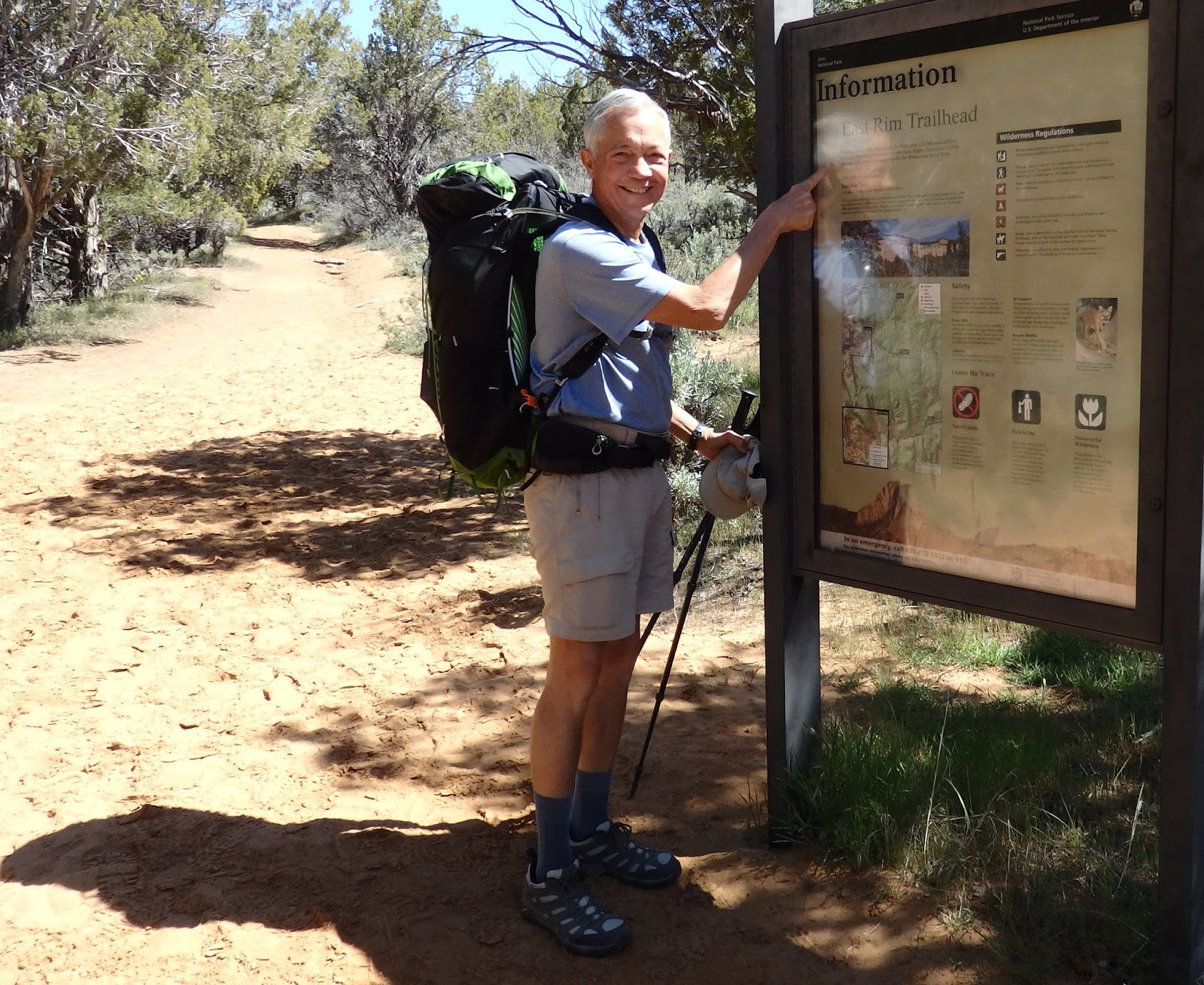 Here is Your Faithful Correspondent about to embark on his trek. His Lovely Bride will accompany him for the first few miles, and then head back to care for our puppies. The trail looks very sandy here. In fact, it is soft, deep sand, hard to hike through. Of the 18 miles or so I would traverse over the next two days, about 15% would be sandy. The weather outlook was good, nights in the 40s and daytime highs in the mid 70s. During the summer, carrying enough water would be problematic, but spring snowmelt was still keeping the few springs running, and I would be able to replenish my water supply at Stave Springs, about 6 miles in.
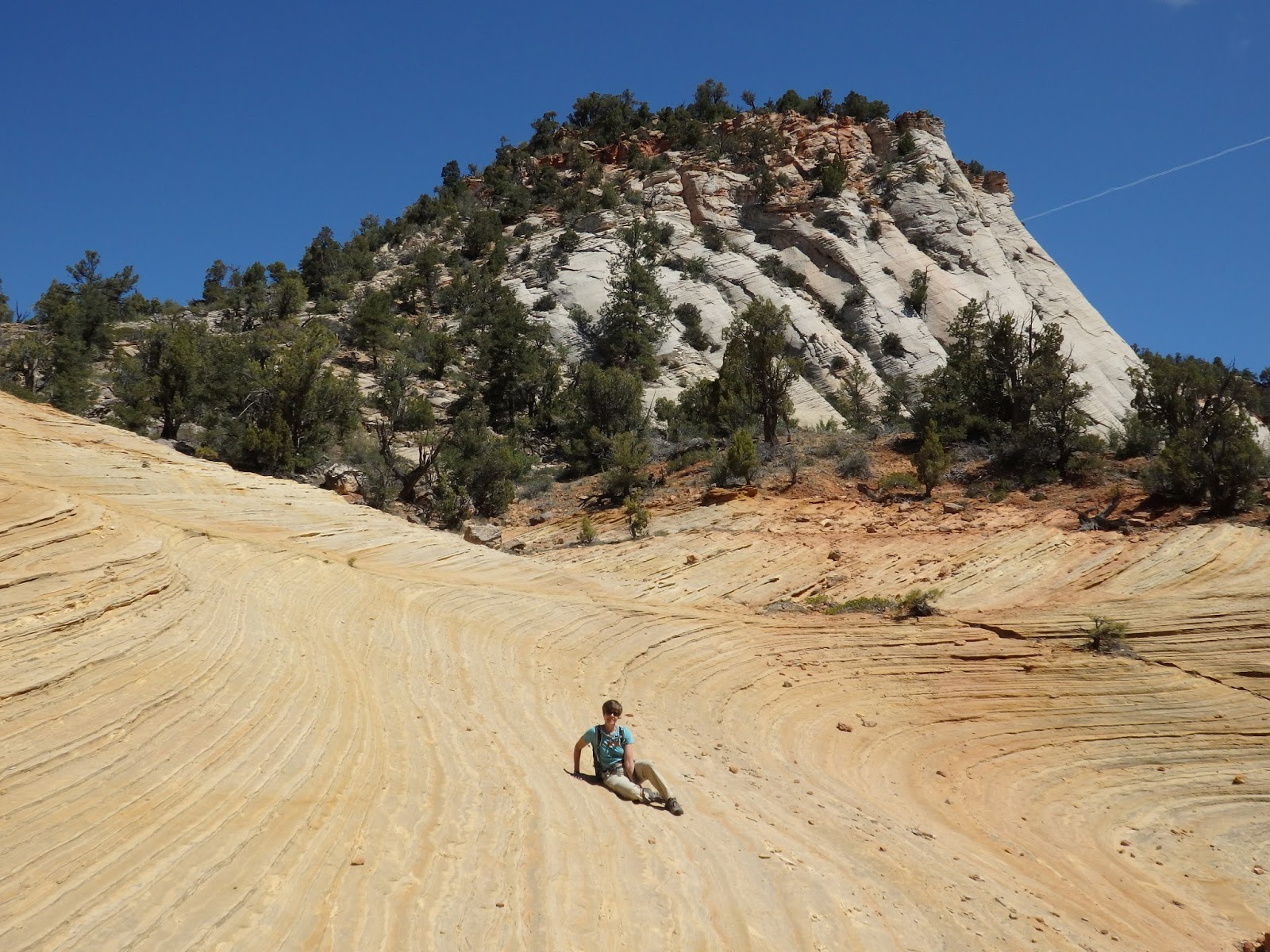 During the hike with Suzanne, we found this stretch of rock in a wave pattern. A closeup might make you think she was on a beach, but the wider angle view shows the true terrain.
  After Suzanne turned back to retrace her steps to the car, I continued up onto a mesa that was cleaved by several canyons, including Jolley Gulch. Jolley’s steep cliffs are a popular canyoneering spot, involving multiple rappels, and there have been several serious accidents here. I am too old these days for real rock climbing, but admire those who do it (safely). Just getting close enough to the edge for a photo makes me a bit queasy, and this is only a few hundred feet down…
 I kept hiking up and up, and arrived at the mesa top and Stave Spring in a couple of hours. The foliage had changed to ponderosa pine forest mixed with junipers and scrub bushes. Near Stave Spring, I met a couple hiking the same trail. I noticed the young woman’s visor and said, “Go Navy! Are you an Annapolis grad?” Lauren Sutehall is indeed a 2007 Naval Academy graduate, and served as a nuclear engineer and Surface Warfare Officer aboard USS Hopper (DDG-70), an Arleigh Burke guided missile destroyer, and the aircraft carrier USS Dwight D. Eisenhower (CVN-69). Her hiking companion, Tim Wilson, is from Capetown, South Africa. We traded Navy stories and then parted for different campsites. They would be the only other backpackers I met during this trip.
 Another hour found me at Cable Mountain (6,798 ft.), where logs and lumber were sent down from here to the Virgin River Valley, 2,136 feet below, from 1904-1911. The sheer cliff is just inches beyond the end of the cable tower.
The view straight down into the abyss. I wonder if the loggers ever tied any poorly-performing men to a log for the quick trip down… that would sure build character and motivation!
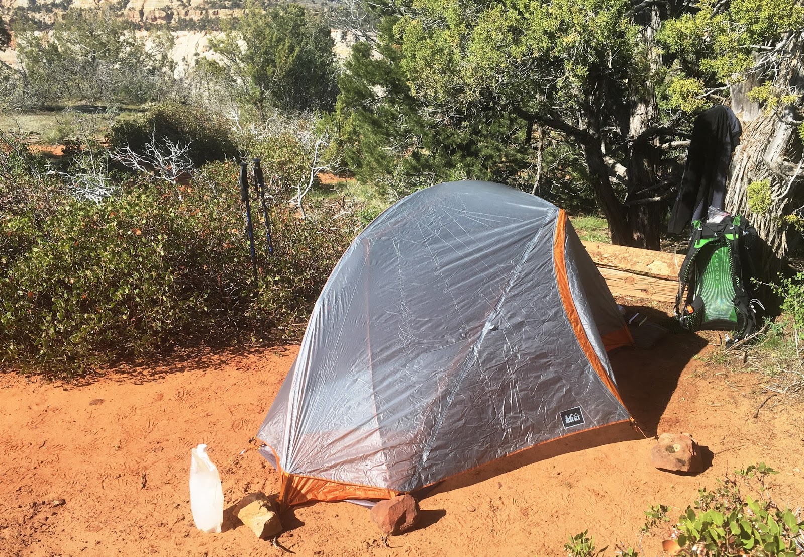 Here are the luxury backpacker accommodations at the top of Cable Mtn, about 60 feet back from the cliff. I was the only one camping out for at least a mile in any direction. (Why do you suppose that was???) The temps didn’t get below freezing, and I was snug as a bug in a rug – as long as I didn’t go sleepwalking. I had a dinner of freeze-dried Thai chicken and rice (Backpacker’s Pantry from New Zealand, very spicy but delicious). There were lots of deer or elk tracks around, but no bugling during the night.
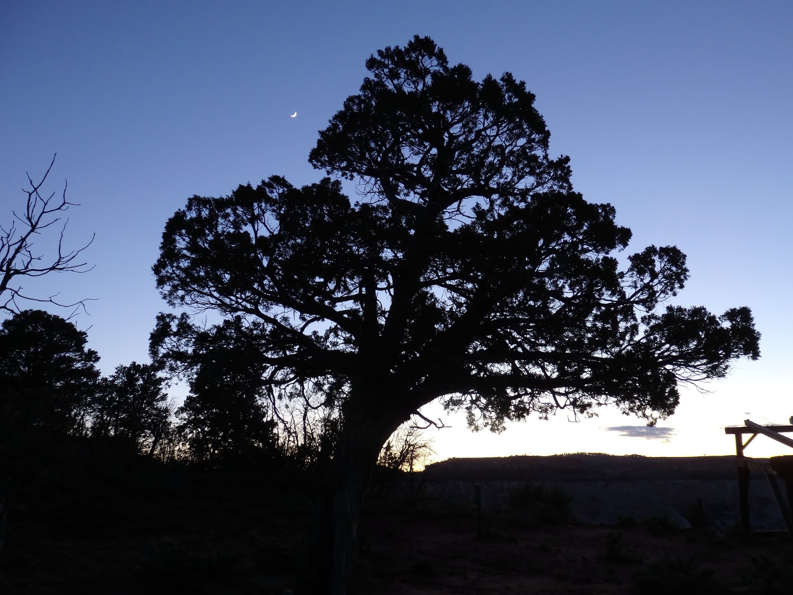 Finally, this dusk silhouette of a big juniper tree near my campsite and a crescent moon behind it provides another clue as to why I do this. Come back in a few days for Zion Part 2 and onward!
1 Comment
Colette
Oenothera speciosa
Evening primrose family