

(When we last left Ty, he was preparing for a two day backpacking trip in Smoky Mountain National Park, while Suzanne would hold down the fort, AKA The Coach, with ferocious guard dogs Rudy and Gretchen, and give a couple of readings …)
 I’ve been a backpacker since my Boy Scout days a few years back, and if I only had one activity to choose from, this would be it. I have never regretted a single day in the backcountry. This was to be a moderate-to-strenuous, 20 mile two day excursion to Marks Cove (Campsite #28 in the Park Service computer) on the Middle Prong Trail, Lynn Camp Prong Trail, the Appalachian Trail, and the Greenbrier Ridge Trail. There would be about 3,300 feet elevation gain from the trailhead to the A.T., which runs along the highest ridges of the Appalachian Mountains from Georgia to Maine. Suzanne drove me down a gravel road three miles south of the Great Smoky Mountain Institute, an environmental education center. But this was no dull, boring gravel road… it follows the Middle Prong of the Little River, one of the prettiest mountain streams you could ever hope to visit.
 I wasn’t sure we would ever get to the end of the road, because My Lovely Bride wanted to enjoy the river views with me before dropping me off. I couldn’t blame her; this was an unspoiled paradise, with only one fly fisherman and a couple taking pictures sharing a mile of river with us. I could tell she appreciated this place as much as I…
 We were surprised to encounter scores of butterflies, mostly Monarchs and black Swallowtails, along the road. (Yes, we stopped the car again…) It was obviously peak season for these spectacular creatures.
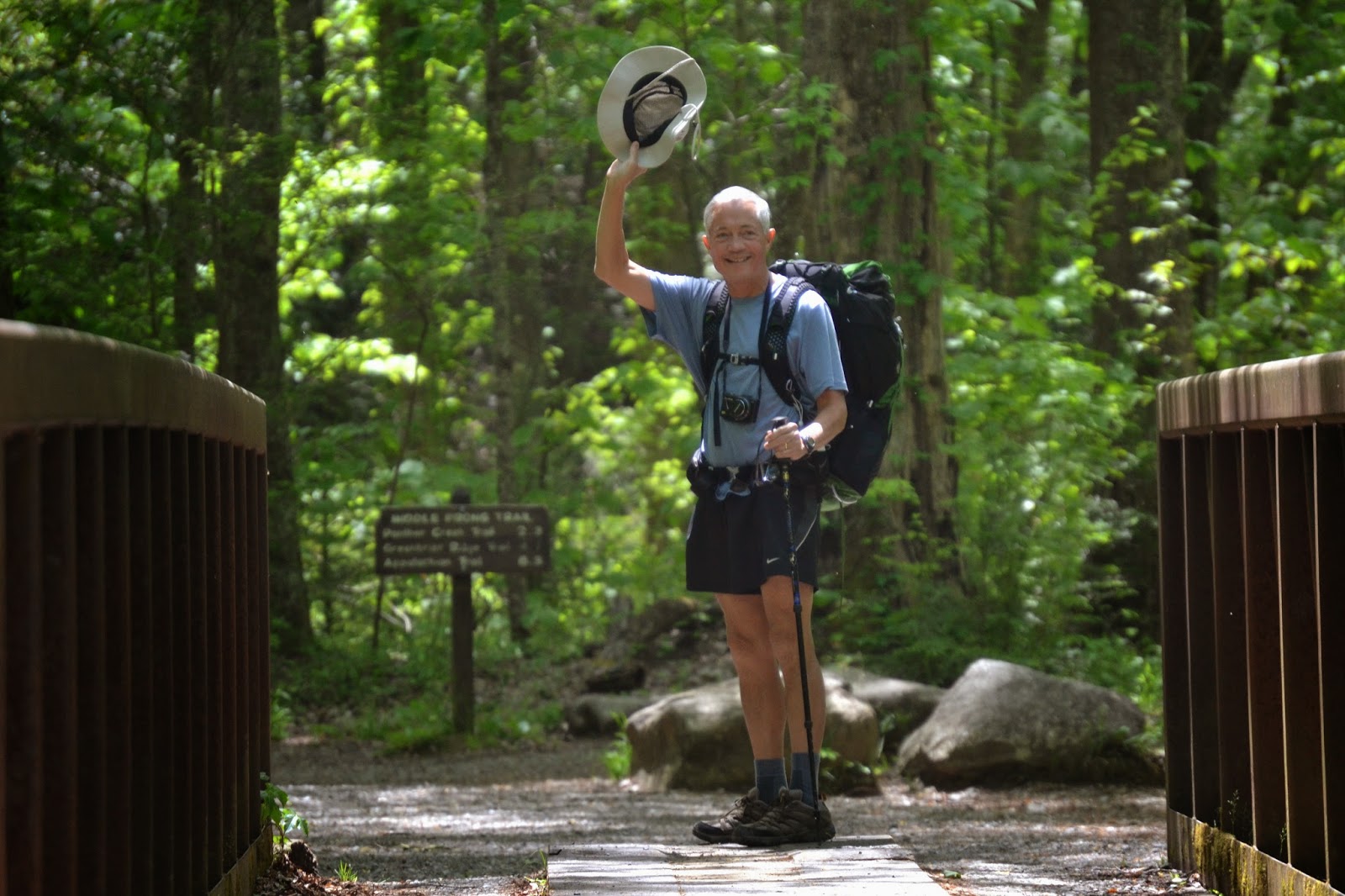 We arrived at the trailhead, where I cinched up my backpack, scratched MLB behind the ears, and gave Rudy and Gretchen farewell kisses (or was it the other way around???) Across the bridge, and turning to wave goodbye, I thought to myself, “Suzanne, thank you for understanding how much I love this…”

The trail rose steadily uphill, following the Middle Prong (like in a fork) for four miles, not always alongside the stream, but usually close enough to hear the rushing waters. I was glad to be here in Spring when the rivers are still at a moderately high level; in August, river levels are lower and their voices much reduced. With lots of annual rainfall, the Smokies are cleaved by dozens of rivers, branches, creeks and prongs. Rainfall varies considerably with elevation, the lowlands receiving about 55 inches annually and the mountaintops, like Clingman’s Dome, getting as much as 85 inches. This makes for a very lush, verdant forest.

I hiked past the remains of a chimney about two miles up the trail, near Lynn Camp Prong Falls. As the Park Service volunteer mentioned the day before, there used to be logging here, as late as the 1940s. This may have been the site of a cabin used by the loggers to support their work before the national park was established. It may also have supported members of the Civilian Conservation Corps; the CCC built many of the trails in our national forests and parks, also providing essential employment for thousands of men during the Depression.

Being a Luddite in many technological areas, I eschewed carrying a GPS, and so was following my topographic map and compass, but trail signs are also handy reminders of which fork in the road to take. Fortunately for those not carrying map and compass, every junction was well-marked, and it would be less easy to get lost here than in more open country out west.

For one thing, the undergrowth is so heavy here that there is nowhere to take off cross-country, unless you were a masochist or totally nutzo. You would need a very sharp machete (or better, a motorized Bush Hog) to rip your way more than a few feet through the rhododendron, honeysuckle, mountain holly, elder, deerberry, sweetshrub, elderberry, and 75 other varieties of shrubs and bushes that reduce even visual distances to less than a hundred feet.

The down side of this thick undergrowth is that if you did happen to get disoriented and fall off the trail, a search party would have a heck of a time finding you. By the way, this is a wide part of the trail that is shared use; both foot and equestrian travel is permitted here, but no mountain bikes. Pure foot trails are generally much narrower.

After three hours of hiking uphill, I had gained a couple of thousand feet and six miles on the trail, and arrived at my designated campsite. The backcountry office guy had said there was still some space here, and he was right. There were 5 or 6 campsites, and every one was empty. Okay, maybe I’m the first to arrive, so since it was “first come, first served”, I did what anyone would do… I picked the Primo Site, right next to the Lynn Camp Prong of the Little River, which here was only about 10 feet wide, and fordable in most places. Here’s a view of my campsite, after I set up my tent, with the stream in the background. It was very private, and I only worried that my future campsite neighbors would be up to all hours partying, since most hikers out here are in their 20s. Also, there was a hitching area about 100 yards away, so there could also be horse packers here with stock, and we all know what big carousers horse people are. (Yes, Jan and Bob, that comment was for you!)
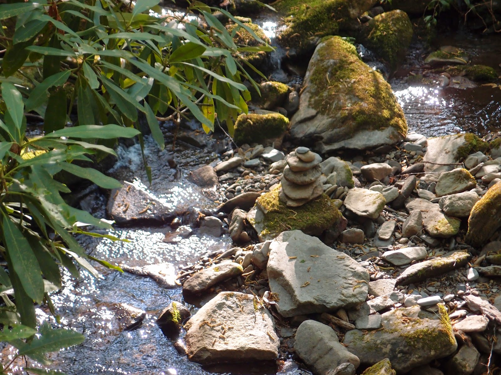 I appreciated this rock cairn placed in the stream at a lovely spot near my tent. What a place to meditate. I sat on a log at the water’s edge for a half hour or so clearing my mind, then thinking deep thoughts. None come to mind at the moment, but they were very, very deep. (Actually, one just popped to mind… would I see bears tonight?)

I fixed dinner, a delightful bag of freeze-dried beef stroganoff with a passable Platypus Cabernet. (What, you’ve never heard of that vineyard? Actually, a Platypus is the brand name of my plastic water bottles that fold flat as a pancake to save space when empty. I have large ones for water and a very small one for a glass or two of wine. Hmmm, I’ll have to ask MLB when I return why she suggested those sizes for those liquids, rather than the opposite…) By then the shadows were lengthening, and the fading sunlight was creeping up the trees. Where were my neighbors? Lost? Eaten by bears? Attacked by wild boars? Come back tomorrow for the thrilling finale…